Firesafe by Nu Terra Labs
REQUEST A MEETING
How can you achieve real-time, accurate wildfire detection and risk assessment to effectively protect your community, infrastructure, and natural resources?
Firesafe addresses the critical need for real-time, reliable wildfire detection, risk assessment, and proactive management to safeguard communities, infrastructure, and natural resources from wildfire threats.
Come visit us at Booth 946!
Firesafe is Transforming Wildfire Management with a hybrid approach
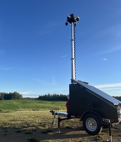
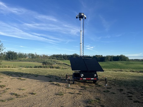
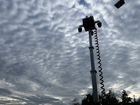
Real Time Surveillance
Advanced solar powered mobile surveillance systems deliver a comprehensive solution for wildfire monitoring and management. Ready to deploy within seconds.
Mobile Units are strategically deployed across vulnerable areas, when needed, ensuring continuous surveillance and early detection capabilities. Connected via 4G/5G networks and Starlink, ensures connection in even the most remote of regions.
Seamless Surveillance, Reliable Response: The AI Solution.
AI enablement is at the forefront of our fire detection system.
FireSafe continuously analyzes data in real-time swiftly identifying and flagging potential fire outbreaks, even in challenging environmental conditions.
Smoke and Ignition events are detected and communicated instantly, enabling rapid response measures to be initiated promptly. Even Better, as the models learn and collect data locally continuously improving the modelling and accuracy.
Drone Surveying: Be Proactive
While mobile surveillance platforms provide ground-level surveillance, detection and notifications, FireSafe Drone Surveying offers a proactive aerial perspective.
FireSafe Drone Surveying are deployed for real-time mapping, providing a dynamic and agile approach to fire management using advanced sensors and imaging technology. This aerial view complements the data from mobile cameras, giving a comprehensive understanding fuel loads, ground conditions, vegetation and potential fire spread; enabling more effective response strategies.
Not Just Drone Mapping: AI Prediction & Analysis
Various factors such as weather conditions, terrain, and historical environmental data are leveraged by FireSafe algorithms to assess the likelihood of fire incidents in specific areas.
This predictive capability allows for proactive measures, such as prioritizing high-risk zones and recommending preventive actions like controlled burns or vegetation management, thereby reducing the overall risk of wildfires.
Hardware and Software Agnostic
Our fire detection solution is designed to be hardware and software agnostic, ensuring compatibility with various platforms and devices.
This flexibility allows for seamless integration with existing systems and easy scalability, making it an adaptable and versatile solution for diverse wildfire management needs.
If any of this interests you check out our website to book a demo or come visit us at booth 946!
Booth Number: 946